
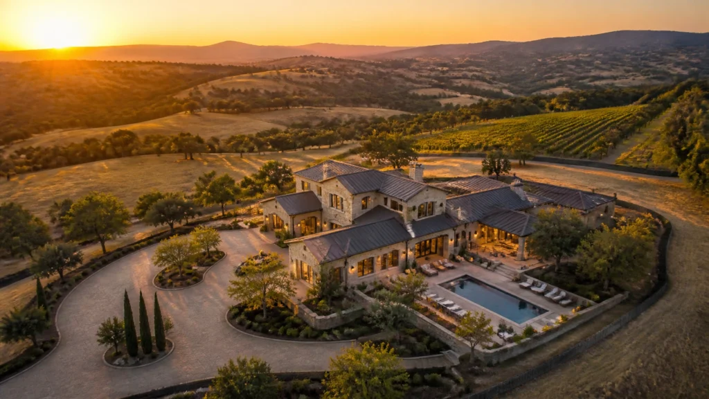
Selling vacant land or large acreage is fundamentally different from marketing a suburban single-family home. When buyers look at a house, they see walls, a kitchen, and a finished living space. When buyers look at raw land, they often see a blank, confusing rectangle of dirt, trees, and tall grass. Without proper visual context, land listings sit on the market for months.
Over my 14+ years in the industry and across more than 10,000 homes and properties photographed, I’ve learned one immutable truth: land doesn't sell itself based on acreage numbers; it sells when the buyer can instantly visualize its potential and boundaries.
If you want to help agents close land deals faster and command premium rates for your media services, you need a repeatable system that combines high-resolution aerial photography, cinematic video flyovers, and precise property mapping overlays. In this guide, I’m breaking down the exact workflow we use at RE Media Systems to turn vacant dirt into a high-value investment.
1. Quick Answer / Executive Summary
If you are short on time, here is the blueprint for marketing land listings effectively:
- The Problem: Standard ground photos and outdated satellite imagery fail to show topography, access roads, and true boundaries, leaving buyers uncertain.
- The Solution: Combine multi-angle aerial stills, a smooth 4K flyover video, and an orthomosaic property map with clear boundary lines.
- The Gear: Use reliable, high-dynamic-range drones like the DJI Air 3S for primary acreage and the ultra-portable DJI Mini 5 Pro for tight neighborhoods or quick deployments.
- The Business Impact: Packaging aerial photography with mapping overlays can support a higher-value land-listing media package when the deliverables justify it.
2. Why Standard Drone Photos Fail to Sell Land Listings
Many photographers make the mistake of treating a 10-acre parcel like a residential roof inspection. They fly straight up to 400 feet, snap three top-down photos of the tree canopy, and call it a day.
To a prospective buyer or developer, that flat, sterile top-down shot tells them almost nothing useful. They cannot tell where the property line ends, whether the slope is buildable, or how close the nearest power lines are.
[ Traditional Satellite Image ] ---> Blurry, outdated, zero elevation detail.
[ Basic Straight-Up Drone Shot ] ---> Confusing tree canopy, no boundary context.
[ RE Media Systems Land Workflow ] ---> Multi-angle perspective + boundary overlays + topographic clarity = Clear Investment.
When you rely solely on generic satellite maps or lazy drone snaps, agents have to field endless phone calls from confused buyers asking basic questions: “Where does the driveway start?” “Is the back half in a flood zone?” “Where are the corners?”
Our mission at RE Media Systems is to eliminate that friction entirely. When you deliver a comprehensive land media package, the visuals answer every question before the buyer even picks up the phone.
3. The Core Principles of Aerial Land Photography
Capturing compelling land imagery requires a deliberate mix of altitudes, angles, and lighting. You aren't just taking pictures of trees; you are documenting an investment asset.

A. The Three-Tier Altitude Strategy
- The Contextual Shot (300–400 ft): Shows the property in relation to nearby highways, towns, lakes, and mountain ranges. This establishes the regional value and neighborhood growth patterns.
- The Boundary Overview (150–250 ft): Captures the entire parcel cleanly within the frame, providing the ideal canvas for property line overlays.
- The Feature Detail (50–100 ft): Focuses on specific selling points: such as an existing barn, a potential building pad, water frontage, or road access points.
B. Timing Your Shoot for Maximum Impact
Lighting makes or breaks acreage photography. Avoid harsh midday sun, which washes out fields and creates deep, unflattering shadows under tree lines. Plan your land shoots during the golden hours: either the first two hours after sunrise or the last two hours before sunset. Low-angle sunlight casts gentle shadows that reveal rolling topography, ditches, clearings, and fence lines that would otherwise remain invisible.
4. How to Overlay Property Lines & Lot Boundaries (Tools & Workflow)
The single highest-value addition you can offer on a land listing is a clear boundary map. Buyers want to know exactly what they are purchasing down to the square foot.
The Mapping Workflow:
- Step 1: Gather Plot Data. Obtain the legal description, GIS parcel data, or surveyor CAD/PDF files from the listing agent or county records.
- Step 2: Capture Orthomosaic Data. If you are doing advanced mapping, program an automated grid flight using your drone's flight planning app to capture overlapping nadir (straight-down) photos.
- Step 3: Overlay Boundaries. Import your high-resolution aerial stills into editing software or specialized property mapping tools. Align the property lines precisely with visible landmarks (fences, tree lines, roads, corner markers).
- Step 4: Add Callouts. Clearly label acreage size, road frontage dimensions, utility hookup locations, and setback lines.

For professional operators scaling into commercial developments and large agricultural tracts, incorporating high-precision tools like an RTK base station ensures centimeter-level accuracy for site planning.
5. Highlighting Topography, Access, and Easements
Land investors care deeply about three things: access, utility, and buildability. Your media must speak directly to these concerns.
- Road Frontage & Access: Always capture a low-angle approach shot coming down the main access road. Buyers need to see if the road is paved, gravel, or dirt, and whether large construction equipment can easily reach the site.
- Topography & Slopes: Use side-lighting and angled drone shots to showcase whether a lot is flat, gently rolling, or steeply sloped. If a lot has a natural elevation advantage that creates a stunning view, make sure that view is documented from the exact height of a future second-story window.
- Utilities & Easements: Highlight utility poles near the property boundary, municipal water hookups, or nearby drainage easements so developers can calculate site development costs instantly.
6. Essential Gear for Land & Acreage Shoots
When you're hiking across 40 acres of rough terrain, tall brush, or muddy fields, bulky equipment becomes a major liability. You need lightweight, highly reliable gear that deploys in seconds.
Recommended Drones:
- DJI Air 3S: Our top recommendation for primary real estate aerial work. Its dual-camera system provides incredible sensor performance, extended battery life, and robust obstacle sensing, making it ideal for sweeping acreage shoots and high-resolution mapping.
- DJI Mini 5 Pro: Perfect for tight urban infill lots, quick neighborhood deployments, and photographers who want a sub-249g powerhouse that travels light without sacrificing image quality.
For a complete breakdown of recommended cameras, tripods, and editing peripherals, explore our Ultimate Real Estate Photography Gear Guide.
7. Pricing Land Media Packages
Many photographers undercharge for land shoots because they treat them like a standard 15-photo interior gig. Land shoots require specialized software, GIS data interpretation, boundary mapping, and significant transit time across rough terrain.

How to Structure Your Pricing:
- Standard Land Media Package: 15–20 aerial stills + 60-second 4K flyover video. Priced 30% higher than a standard interior package.
- Complete Land & Mapping Package: Includes aerial stills, flyover video, plus an orthomosaic map with property lines, acreage callouts, and access markers. Priced at 2x to 2.5x your base real estate package.
By bundling mapping and boundary overlays into your service menu, you position yourself as a specialized land media expert rather than just someone with a flying camera. For detailed pricing strategies, review our Real Estate Photography Pricing Guide.
8. Common Mistakes Photographers Make on Land Shoots
Even experienced photographers make avoidable errors when transitioning from residential interiors to open land. Here are the top mistakes to watch out for:
- Flying Too Low Near Power Lines: Acreage parcels often feature hidden overhead utility lines crossing driveways or pastures. Always conduct a visual walk-around before taking off.
- Ignoring the Wind: Open fields offer zero windbreaks. Higher altitudes can introduce severe camera jitter. Monitor weather conditions and use robust stabilization.
- Failing to Verify Boundaries: Never guess where property lines lie. Always require the agent to provide official GIS maps or surveyor plats before adding line overlays.
- Neglecting Ground-Level Details: While drone shots are crucial, don't forget to photograph entry gates, signage, water meters, and soil markers from the ground.
9. Frequently Asked Questions
Do I need an FAA Part 107 license to shoot land drone photography?
Yes. Any commercial real estate photography or mapping: whether residential, commercial, or raw land: requires an active FAA Part 107 Remote Pilot Certificate in the United States.
What is an orthomosaic map?
An orthomosaic map is a high-resolution, geometrically corrected image created by stitching together dozens or hundreds of overlapping drone photos captured in a grid pattern. It provides an accurate, measurable top-down view of the property.
How do I add property lines to drone photos?
You can use specialized real estate mapping software, Adobe Photoshop, or tools like Canva and dedicated land-mapping applications to draw precise boundary lines over your high-resolution aerial stills.
What is the best drone for shooting large acreage?
The DJI Air 3S is currently our top recommendation due to its dual-camera versatility, extended flight time, and superior low-light performance over large areas.
How many photos should I deliver for a 5-acre lot?
Typically, 15 to 25 edited aerial stills covering wide context, medium boundaries, and key features (plus 1–2 annotated boundary maps) provide the perfect balance for an MLS listing.
Can I fly my drone over livestock on rural land?
You should always avoid hovering low over livestock, horses, or wildlife, as the drone noise can cause panic and injury. Maintain a respectful altitude when flying over working farms and ranches.
How do I handle overcast weather on a land shoot?
Overcast skies actually provide soft, even lighting for large land parcels without harsh shadows. However, if colors look flat, use subtle clarity and contrast adjustments in post-processing to make greens and earth tones pop.
Should I include video with land listings?
Absolutely. A 45 to 60-second cinematic flyover helps buyers understand the flow of the terrain, road access, and surrounding neighborhood far better than static images alone.
How do I price acreage mapping services?
Charge an hourly rate or a flat add-on fee (e.g., $150 to $300 extra) on top of your base aerial package to account for the time spent processing maps and aligning boundary lines.
What tools do you recommend for managing land media delivery?
Platforms like HDPhotoHub allow you to deliver high-resolution photos, interactive maps, and property videos seamlessly to agents while managing client invoicing.
How far in advance should I scout a land site?
Whenever possible, review the parcel on Google Earth Pro or satellite imagery prior to arrival to identify potential launch spots, obstacles, and solar angles.
How do I upsell agents on land mapping?
Show them an example of a competitor's listing that lacks boundary lines versus your annotated map. Agents immediately recognize that clear maps eliminate buyer confusion and sell land faster.
10. Summary & Actionable Next Steps
Vacant land doesn't have to be a tough sell. By treating land listings with the same professional rigor as multi-million dollar luxury homes: combining multi-altitude aerial stills, smooth video flyovers, and clear boundary mapping: you provide undeniable value to real estate agents and investors.
Ready to elevate your real estate media business, streamline your workflows, and increase your per-shoot revenue?
- Join our community: Connect with fellow media professionals inside the RE Media Systems Community.
- Equip your business: Explore our tested gear recommendations on the Recommended Gear Page.
Master these systems, shoot faster, earn more, and build a thriving real estate media business that stands out in any market.